Three Sisters Wilderness 50 mile hike, day 7
The next morning the wind had settled down. One of the Scouts woke with
a stiff neck that we thought would work itself out within a short time.
By lunch we had traveled over Opie Dildock Pass and the stiff neck had
not gone away. Dave and I discussed the issue then discussed it with
the Scouts. We decided to head out to the car rather then stay the last
night. We did not know what was causing the stiff neck and that
concerned me. Also, we knew it was not going to be a very pleasant
night for the Scout. Other factors that added to our coming out early
included not having a shower for seven days, the thought of having a
soft bed to sleep in, ...
This last day turned into a 13 mile day. It was exhausting but we were
out and on our way home.
The Scout went to the doctor and the stiff neck was pretty minor. We
still made the right decision, Safety First!
It was a great trek. Every one that was back packing is a great
backpacker. Even though the trek had some very long walk times,
everyone was exhausted and had sore feet; everyone still got along very
well together. You could not ask for a better group of people to go
back packing with.
-- John D
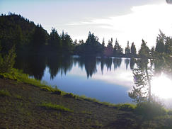 Morning at South Mattheiu Lake.
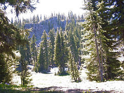
 Our journey today turns out to carry us over lava fields, alpine woods,
snow fields, and finally forest.
Our journey today turns out to carry us over lava fields, alpine woods,
snow fields, and finally forest.
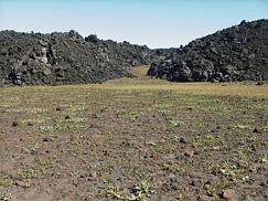
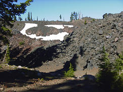
 Here is an example of a lava flow which ran out of steam, and just
stopped. It doesn't flow to fill in low areas.
Here is an example of a lava flow which ran out of steam, and just
stopped. It doesn't flow to fill in low areas.
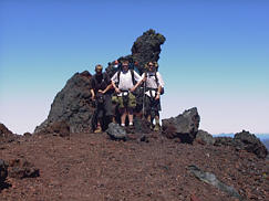
A volcanic ridge which has a portion broken out.
I had remembered this from a previous trip when I
came to this area via a different trail.
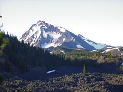
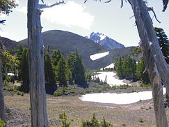 Collier Cone is in the shadow of North Sister.
Okie Dildock Pass in in this region, and is another place
we had to get to 7,000 ft.
Collier Cone is in the shadow of North Sister.
Okie Dildock Pass in in this region, and is another place
we had to get to 7,000 ft.
Our elevation ranged from about 5,400 ft. to 7,000 ft. with the
exceptions of the South Sister summit (10,358 ft.) and the trail head
which was at 4,800 ft.
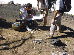
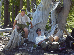
 Sean examines a map looking for the right way to go.
He is sitting on an arrow made of stones which is pointing the way.
Sean examines a map looking for the right way to go.
He is sitting on an arrow made of stones which is pointing the way.
Sean made his way though the trek using the map to maintain his way
for the scouts. He didn't have any problems with it.
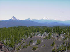
Looking to the North, you can see Mt. Washington, Three Fingered Jack,
Mt. Jefferson, and Mt. Hood.
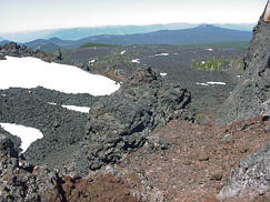 The lava fields we had to cross were quite impressive.
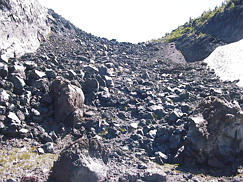
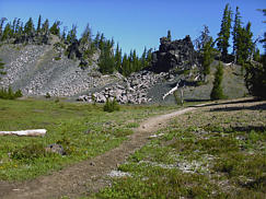
 This rock pile contains the trail we just came down.
Again, the people who built the trail did a very good job considering
some of the obstacles in the way.
This rock pile contains the trail we just came down.
Again, the people who built the trail did a very good job considering
some of the obstacles in the way.
Obsidian cliffs by daylight.
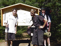 The end of the trip, and everyone was happy to see the car.
If you have any question about this page, send mail to
Dave Regan